

No need to turn the TV on to see what the weather is going to be like in the hours to come, a simple glance at your barometer is enough to indicate you the weather tendency. But did you know that wind also gives hints about the future weather? In this article, we will explain to you how the wind forms and why it is worth observing it.

Where does the wind come from?
Even if the wind can turn out to be a nuisance (remember that walk on the beach, hair in your face) or even dangerous during severe storms, it plays an essential role in nature: oxygenation of oceans, dispersal of minerals, reproduction of some plants… But where does the wind, so beneficial to our planet, originate?
The wind is an airmass that travels in the atmosphere. This airmass moves as a result of a variation of temperature and atmospheric pressure.
As solar radiation is not equivalent everywhere on the planet, it creates airmasses of different temperatures. Hot air, which is light, goes up into the atmosphere and creates a zone of low pressure (depression). Conversely, cold air, that is denser, goes down towards the earth surface triggering a zone of high pressure (anticyclone).

The air in the zone of high pressure (cold airmass) moves towards the zone of low pressure (hot airmass). It is this air stream that we call “wind”. It aims at regulating temperatures and consequently the pressure difference between these two airmasses. Bigger the pressure difference, stronger the wind.
However, the wind cannot travel as it wishes. Its trajectory is diverted by Coriolis force (centrifugal force) which prevents it from going directly into the zone of low pressure. Therefore, air does not move in a straight line but spirally. In the northern hemisphere, the too heavy cold air goes down towards the terrestrial surface by swirling clockwise to leave the anticyclone. Conversely, hot air, that is lighter, goes up swirling anticlockwise once it gets sucked up by a depression.
While it travels the terrestrial surface, the cold air stream is subject to several factors that prevent it from maintaining its temperature. Indeed, cold air will endure frictions on terrestrial surface and will go through zones where temperature is higher. As a result, this cold air warms up and gets humid. The wind will carry this heat and humidity to the zones of depression. It is by sucking up this hot air that zones of low pressure develop clouds and rainfalls.

As you can see, wind is an essential element to maintain a certain balance in our atmosphere.
The wind’s role in weather forecasts
To predict the colour of the sky in the hours to come, it is essential to observe the variation of atmospheric pressure. The latter will indicate you if an anticyclone or a depression is coming, that is to say if the weather will be clement or get bad. The barometer, measuring instrument for this pressure, is the perfect tool to help you forecast the sky tendency on a daily basis, without having to consult weather reports. To obtain even more precise forecasts, you can combine the barometer’s data with the wind’s data.
To do so, there are measuring instruments specific to the wind: the anemometer and weather vane.
The anemometer is used to measure windspeed. By comparing this data to Beaufort scale, you can determine the wind force and its impact on the environment. Higher the scale score, stronger and more dangerous the wind.

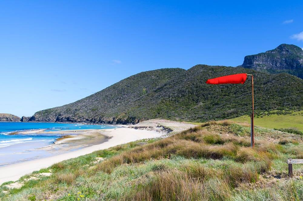
In addition to the anemometer, it is interesting to observe the weather vane’s position. The latter indicates the wind’s direction. It is important information as it gives additional information about the weather.

In addition to the anemometer, it is interesting to observe the weather vane’s position. The latter indicates the wind’s direction. It is important information as it gives additional information about the weather.
Indeed, the wind’s direction has an impact on humidity and air temperature, which varies the atmospheric pressure. In summer, northerly or easterly wind is synonymous with clear sky and with hot and dry weather. In winter, it also calls for dry but cold weather.
During summertime, southerly wind is a sign of heat and humidity. A weather combination which presages a risk of thunderstorms.
Furthermore, westerly wind is not a good sign. It brings a fresh breeze, enjoyable in summer, but with a risk of rain that could spoil your holidays. In winter, it is the same thing. A westerly wind is a sign of rain.
Keep an eye on your weather vane! If it indicates a south-westerly wind in winter, stay at home, as a storm is about to come.
Forecasting the weather very accurately requires you to observe several phenomena like the atmospheric pressure, humidity, temperature but also wind. Now, you know what you need to do to become a true weather master.


